The villages Barcelona absorbed
Gràcia, Sants, Sant Andreu, Sant Martí, Horta and Sarrià were not neighbourhoods waiting for Barcelona. They were municipalities with streets, governments and institutions of their own.
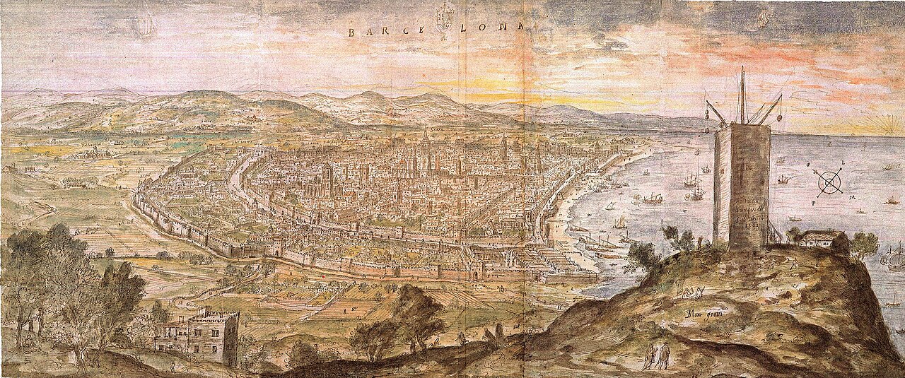
Panoramic view of Barcelona drawn by Anton van den Wyngaerde, 1563.
Wikimedia Commons · public domain · source

A square that still feels like a centre
In Plaça de la Vila de Gràcia, the clock tower stands in the middle of a space that feels less like an absorbed periphery than the centre of a small city. The former town hall, narrow streets and sequence of squares recall a place that developed according to its own logic before Barcelona made it a district.[1]
The story recurs in different forms throughout the present municipality. Modern Barcelona did not merely spread across empty fields. It incorporated towns and municipalities that already had parishes, markets, factories, roads, cemeteries, societies, festivals and political disputes. Annexation abolished town councils. It did not erase the city those councils and communities had organised.
A ring of municipalities
During the nineteenth century, industrial and demographic growth strengthened the settlements of the plain. Sants developed along the road to Madrid and around factories. Sant Martí de Provençals combined agriculture, older nuclei and industrialisation that would turn Poblenou into a major manufacturing landscape. Sant Andreu de Palomar retained a linear centre, local institutions and a close relationship with the Rec Comtal.[2][3]
Gràcia developed a dense fabric of plots and squares. Horta kept a geography of valleys, torrents, farmhouses and summer residences. Sarrià preserved a municipal and social identity strong enough to resist annexation longer than most. Each belonged to a metropolitan Barcelona taking shape, but they did not belong to the same Barcelona.
What annexation changed
Incorporation allowed infrastructure to be planned at a larger scale: sewers, transport, taxation, roads and urban development. It also concentrated authority. Decisions once made in a local town hall now depended on Plaça de Sant Jaume. A municipality’s name might survive as a district, neighbourhood or group of neighbourhoods, but its former territory no longer necessarily matched the new administrative map. That difference still complicates language. “Sant Martí” can mean a former municipality, a current district or a shared history spread across very different neighbourhoods. “Sant Andreu” may refer to the old centre, the district or a sense of belonging that crosses official boundaries. Administrative atlases create order. Local memory overflows it.
What survived
Old centres, commercial spines, bell towers, markets and annual festivals survived. So did rivalries and everyday vocabulary: people could continue going “to Barcelona” after legally becoming part of it. Clubs, ateneus, cooperatives, parishes and associations maintained a scale of life that did not coincide with the metropolis. In Sant Andreu, Carrer Gran remains a spine older than integration into the large city. In Sants, the road, industrial fabric and associative network explain an independent centrality. In Sant Martí, the distances between the Clot, Poblenou and the Besòs sectors recall that the former municipality already contained different worlds before administration divided them.
Absorption is not homogenisation
Barcelona gained land and population. The annexed municipalities lost formal sovereignty. Yet the result was not complete dissolution. Former towns continued to produce identities, organisations and urban forms that required the centre to deal with multiple local centres. Return to Plaça de la Vila. The clock still marks time from the centre of Gràcia. It no longer regulates an independent municipality. It still tells us that this place did not begin as a neighbourhood.
Static map: official neighbourhood boundaries (CartoBCN)
Related neighbourhoods
Sources
- [1] Ajuntament de Barcelona. Història de Gràcia. ↩
- [2] Ajuntament de Barcelona. Història de Sant Martí. ↩
- [3] MUHBA. Sant Andreu de Palomar, de poble a barri de Barcelona. ↩
- [4] MUHBA Oliva Artés. La formació d’una metròpoli.