Making and remaking the waterfront
The line where Barcelona meets the sea has moved repeatedly. Sediment, docks, railways, shacks, factories, beaches and redevelopment have produced many different coasts.
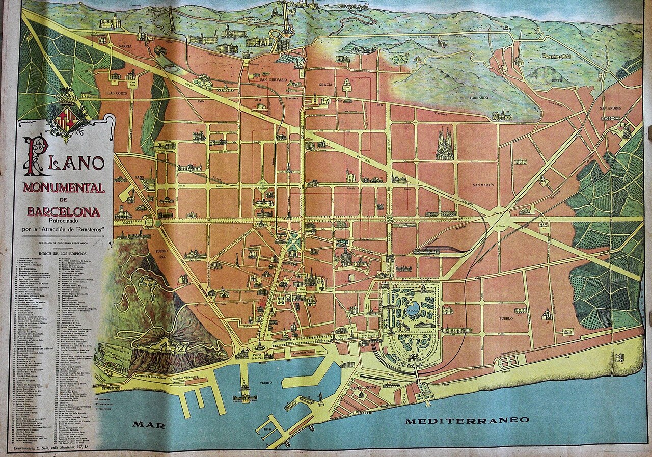
Map of Barcelona published in 1920, when the urban fabric was already much larger.
Wikimedia Commons · CC BY-SA 4.0 · source

The sea that reached further inland
At the Born, the medieval shoreline lay closer than the present map suggests. Sediment, port construction and urban expansion moved the waterline. Reading the old coast requires imagining sea where streets, buildings and infrastructure now stand.[1]
A coast is not a fixed boundary. It moves through natural processes and engineering decisions. Every breakwater modifies currents and sediment; every embankment creates land; every new beach is also a maintenance project.
Barceloneta: a neighbourhood on manufactured land
Barceloneta emerged from a particular relationship between port, fortress and sea. Its narrow plan, housing and maritime activity cannot be separated from territory created and disciplined by the state. Fishing, dock labour, workshops and bathing successively occupied a changing edge.[2]
Proximity to the sea did not mean free access. Docks, installations, railways and port labour could make water productive space before it became recreational space. The public beach is one historical phase, not the timeless essence of the neighbourhood.
The industrial coast
Towards Poblenou, railway and factories formed a longitudinal barrier. The city produced beside the sea while being separated from it. Between industry and beach, settlements such as Somorrostro housed thousands of people in precarious conditions before twentieth-century clearance and redevelopment. This complicates the language of “recovering the sea”. The sea had not been lost in the same way by everyone. It was workplace for some, home for others and an inaccessible or polluted edge for many.
The Olympic opening
Transformation associated with 1992 removed rail and industrial uses, created beaches, parks and Vila Olímpica and established a continuous promenade.[3] Public access is real and valuable. So is erasure: a productive and socially contested coast was replaced by a cleaner residential and tourist image. Further north, Diagonal Mar and the Fòrum continued manufacturing coastline through large plots, infrastructure and new public spaces. At the Besòs mouth, city, river, water treatment, energy and sea meet on a coast that remains highly technical.
A line requiring maintenance
Urban beaches depend on sand, cleaning, protection and decisions after storms. The port continues to expand and specialise. Climate change adds erosion and risk. Barcelona’s most photographed edge is infrastructure under permanent work. Understanding the waterfront requires maps to be layered. Medieval sea, port neighbourhood, railway, Somorrostro, factory, Olympic beach and Fòrum are not episodes aligned along one unchanged coast. They are different coastlines built over one another. On the promenade, waves reach a line that looks natural. The city has worked for centuries to place it exactly here.
Static map: official neighbourhood boundaries (CartoBCN)
Related neighbourhoods
Sources
- [1] MUHBA. De la platja al port. ↩
- [2] BCNROC. Barceloneta neighbourhood guide and landscape dossier. ↩
- [3] BCNROC. Barcelona Olympic transformation. ↩