Barcelona before Cerdà
Before the grid, the plain was not empty. Roads, fields, irrigation, factories, towns, property and a military building exclusion already organised it.
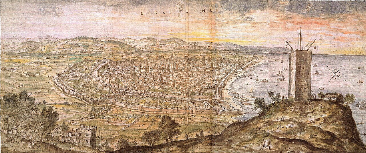
Panoramic view of Barcelona drawn by Anton van den Wyngaerde, 1563.
Wikimedia Commons · public domain · source

The path before the street
Passeig de Gràcia now appears central to the Eixample. Before it became an urban promenade and commercial axis, its direction connected the walled city with the town of Gràcia. The future grid did not invent every line. It crossed, absorbed and straightened an existing geography. The same was true of the road through Sants, the route towards Sant Andreu, axes leading to the Clot and paths leaving the city gates. The Barcelona plain was already a territory of movement. Carts, goods, people, water and animals had drawn a network before planning converted it into streets.
The military void
A zone around the walls was subject to military restrictions. Dense Barcelona remained compressed while surrounding land could not be freely developed. This separation sharpened the contrast between the crowded city and the settlements of the plain growing according to other logics. When the walls lost their function and demolition began, the question was not simply how to enlarge Barcelona. It concerned who would control an enormous area of land, how municipalities and infrastructure would be connected and what form of life the extension would produce.[1]
A worked plain
Outside the walls were fields, irrigation channels, farmhouses, convents, cemeteries, factories and estates. The Rec Comtal crossed the northern plain; roads structured plots; early industry sought water, space and connections. Gràcia, Sants, Sant Martí and other municipalities were not passive satellites but centres with development of their own. Cerdà’s grid is consequently clearest where it could impose extended regularity and more complicated where it met older routes, property and nuclei. Exceptions are not failures of the plan. They are evidence of the preceding city.
1859: deciding the future city
In 1859 different proposals competed to define Barcelona’s extension, and Cerdà’s project would establish the large structure of the Eixample.[2] It proposed an open network, circulation, ventilation and a new relationship between block, street and facilities. Implementation was not a pure translation of the drawing. Property, business, regulation and construction altered density, courtyards and use.[3] The built city emerged from an encounter between the plan and the interests materialising it.
Seeing what came before
Churches, farmhouses and older routes became trapped inside blocks. Some streets change angle because they follow an earlier path. Diagonal cuts the grid as a metropolitan line, while other axes preserve directions much older than the Eixample.[4]
Reading Barcelona before Cerdà does not diminish his plan. It makes the plan more exact. The grid did not fall on blank paper. It negotiated with territory already inhabited, worked and contested. On Passeig de Gràcia, the city seems to proceed in a straight line. Beneath it remains the path that once ran from one city to another.
Static map: official neighbourhood boundaries (CartoBCN)
Related neighbourhoods
Sources
- [1] MUHBA. Decidir la ciutat futura: Barcelona 1859. ↩
- [2] MUHBA. L’Eixample Cerdà. ↩
- [3] MUHBA. Raó, passió i negoci en la construcció de l’Eixample. ↩
- [4] BCNROC. Avinguda Diagonal guide. ↩